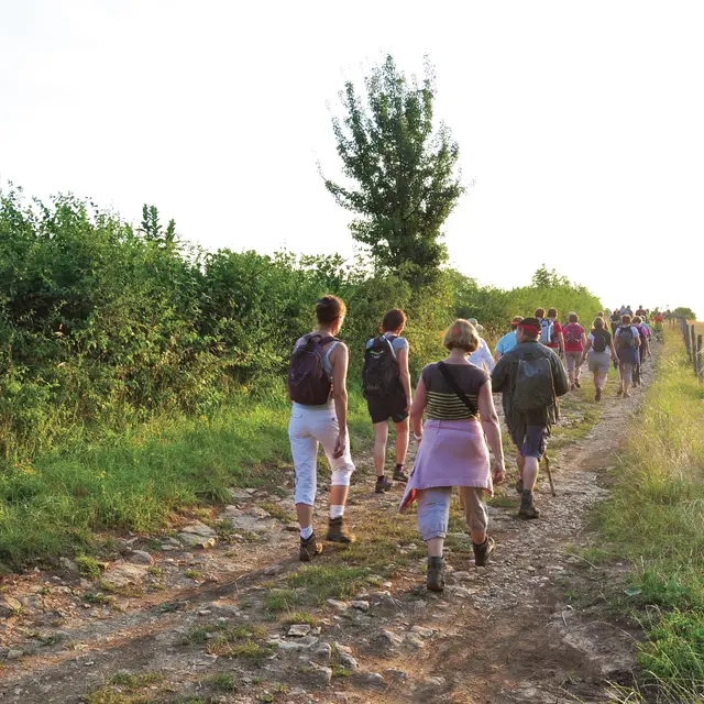
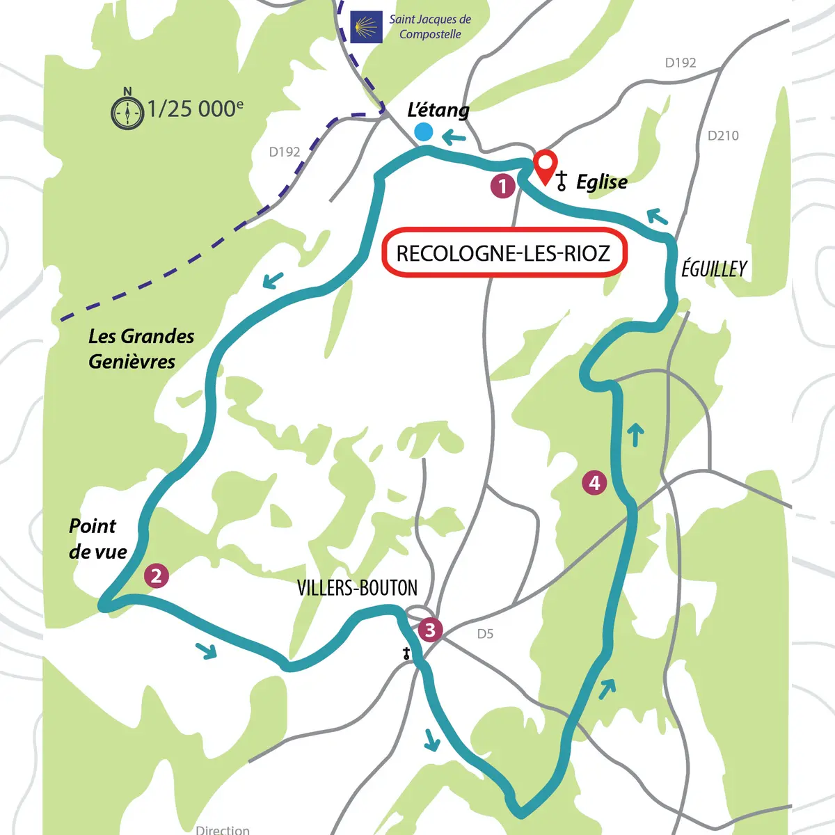
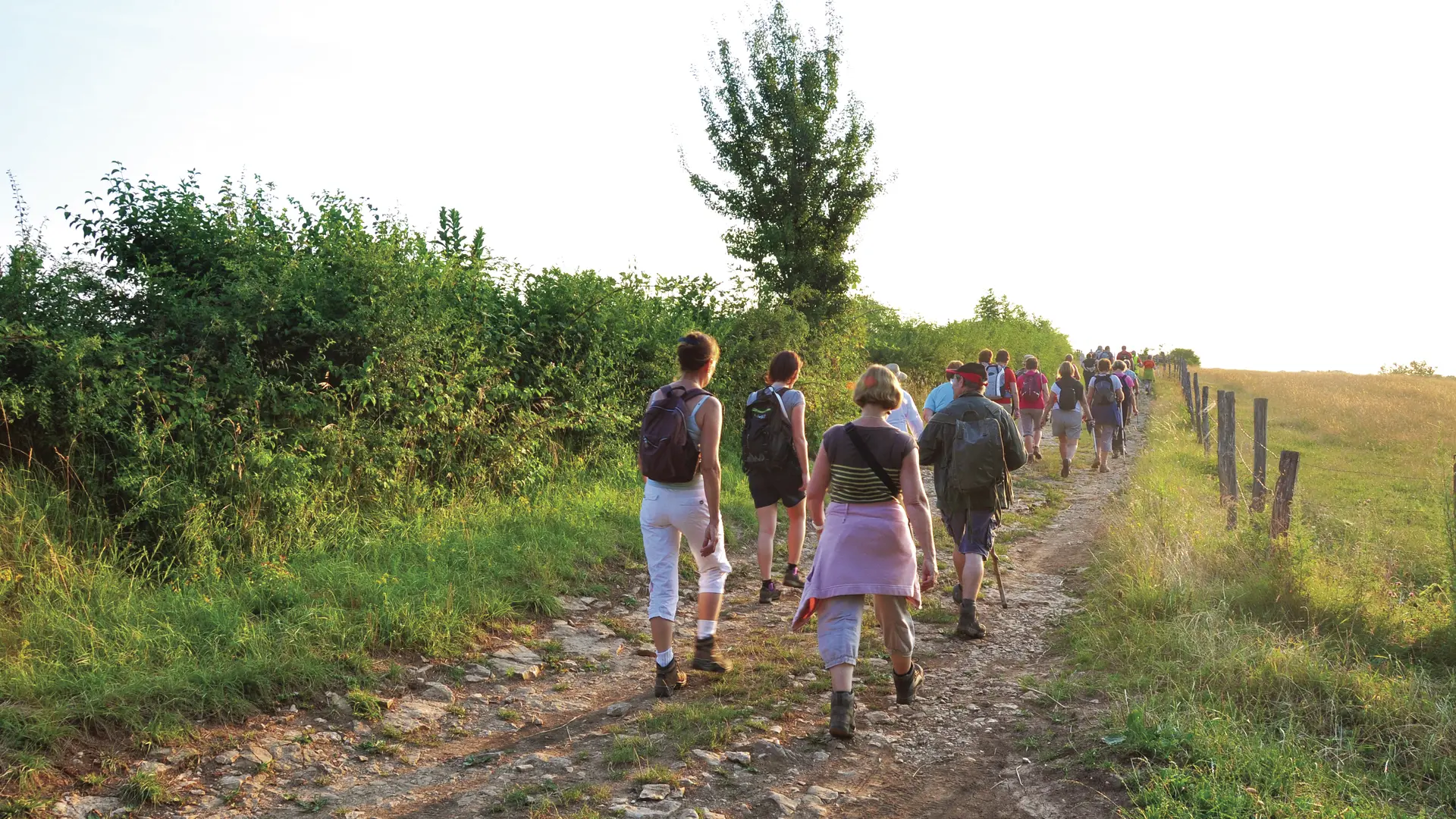
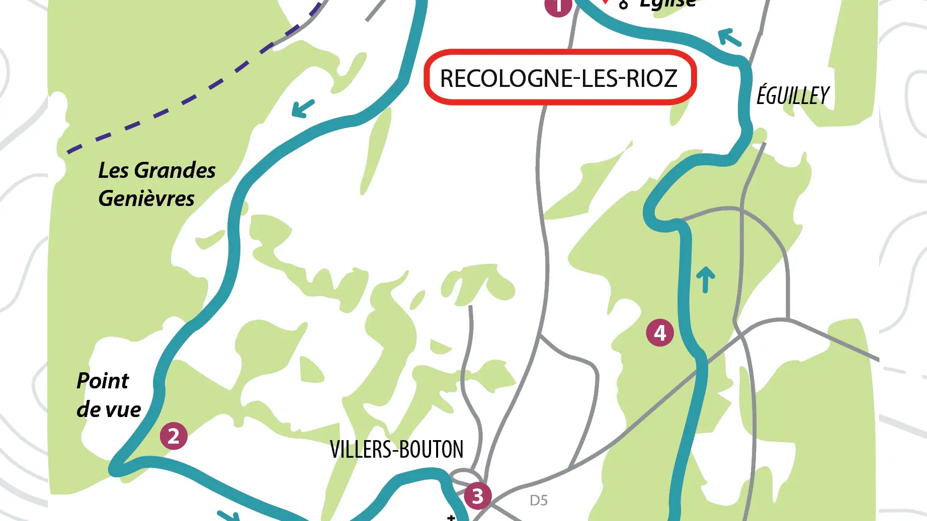
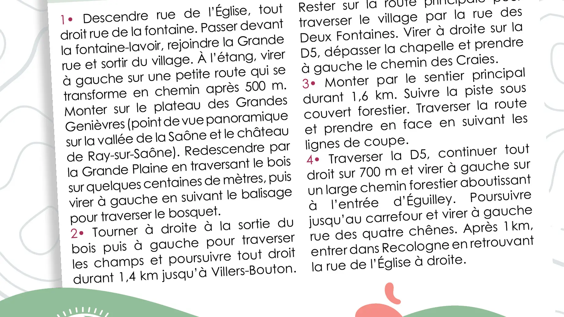
1- Go down in the street "rue de l'église", straight ahead in the street "rue de la fontaine". Walk past the fountain-washhouse, join the main street and leave the village. At the pond, turn left on a small road which becomes a track after 500 m. Climb up to the Grande Genièvres plateau (panoramic view of the Saône valley and Ray-sur-Saône castle). Descend via the Grande Plaine, crossing the wood for a few hundred metres, then turn left following the signs to cross the copse.
2- Turn right as you leave the wood, then left to cross the fields and go straight on for 1.4 km to Villers-Bouton. Stay on the main road and go through the village via Rue des Deux Fontaines. Turn right onto the D5, pass the chapel and turn left onto the Chemin des Craies.
3- Go up the main path for 1.6 km. Follow the forest track. Cross the road and go straight ahead following the cut lines.
4- Cross the D5, go straight on for 700 m and turn left onto a wide forest track leading to the entrance of éguilley. Continue as far as the crossroads and turn left onto rue des quatre chênes. After 1km, enter Recologne by turning right into rue de l'église.
Read more