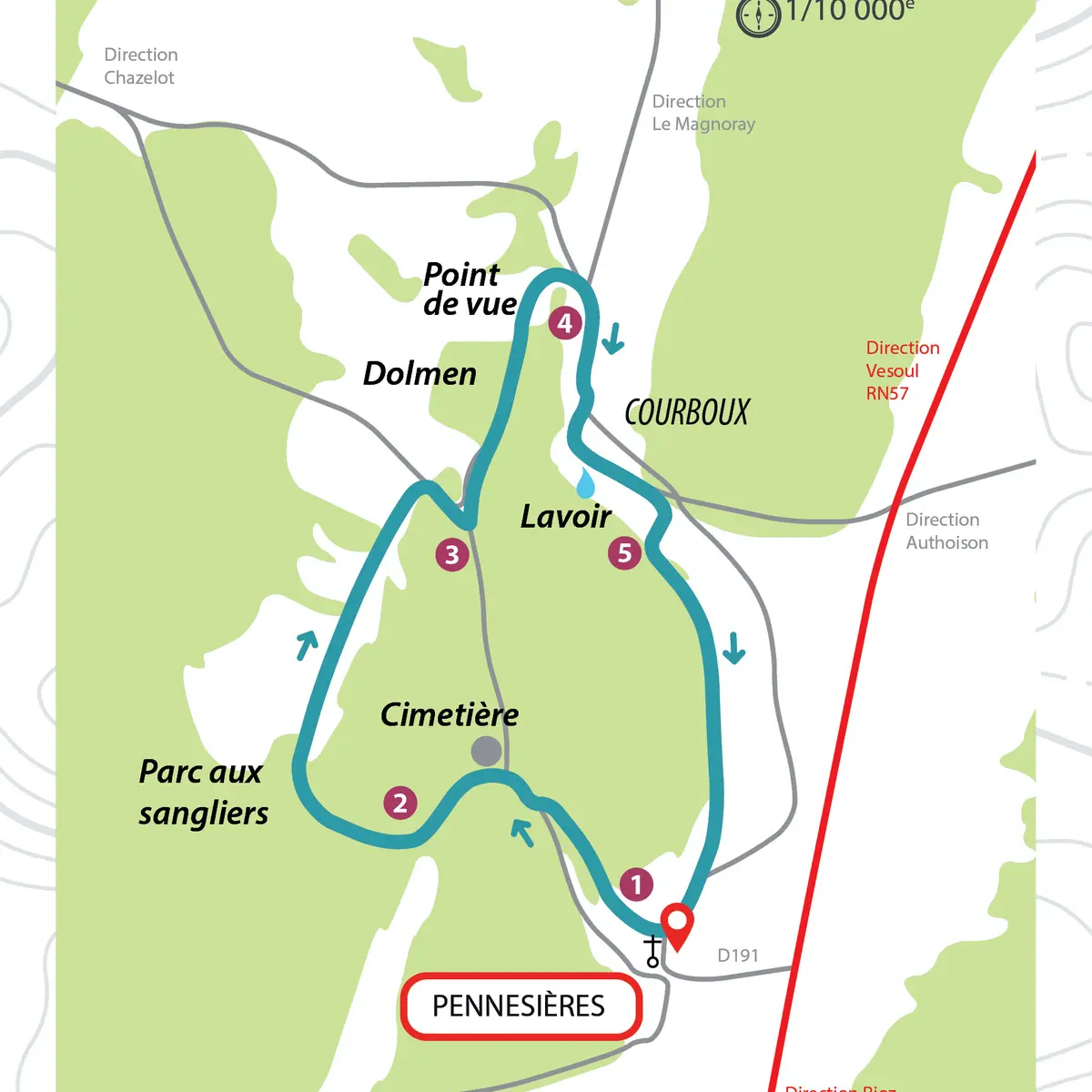
1- Place de l'église, take rue de La Goula, then the tarred road for 100 meters. At the cemetery, turn to the left on a stony track.
2- Turn to the right and go along the wild boar park. When you reach the tarmac track, turn right.
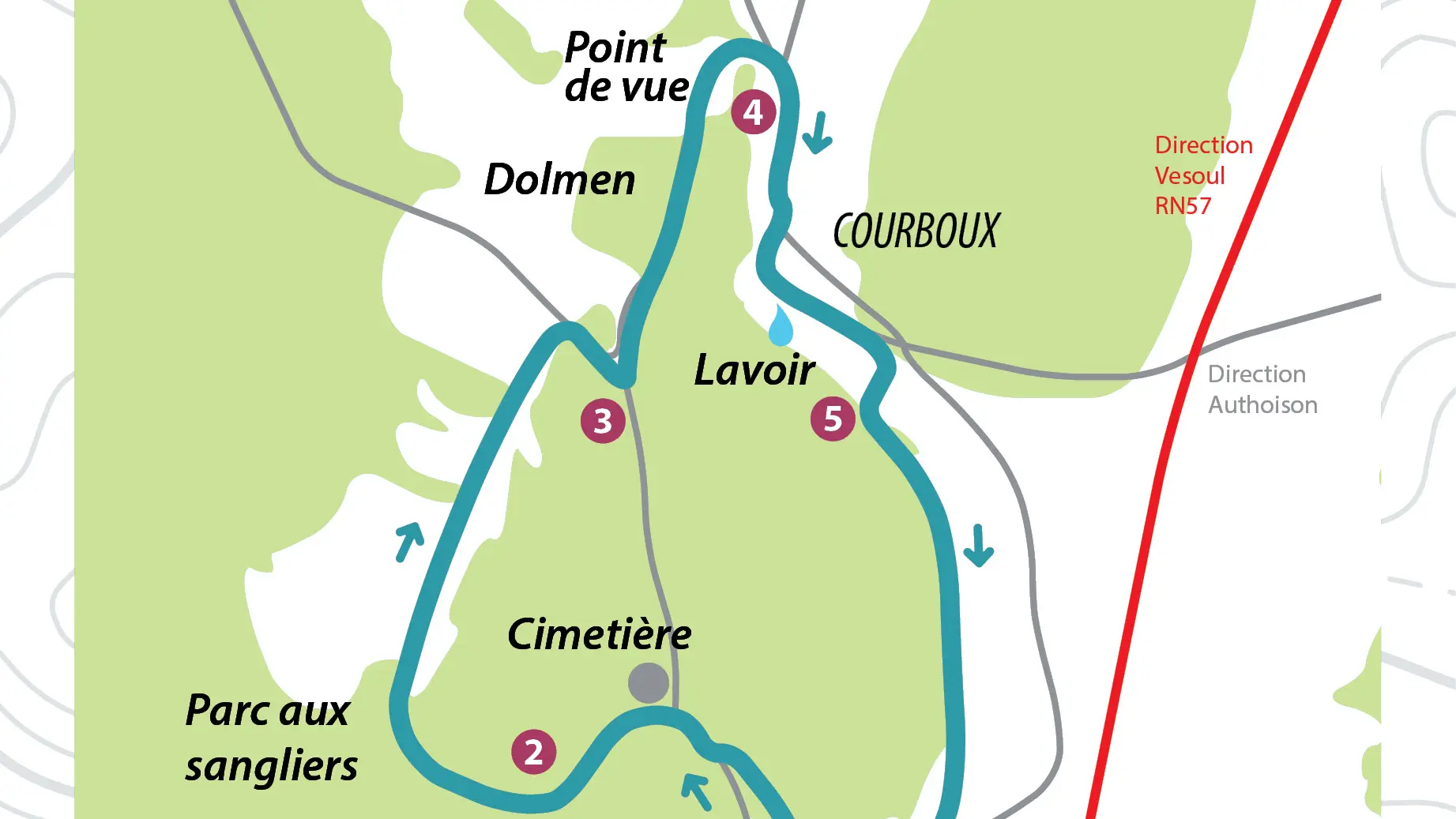
3- At the end of the small wood, turn left on the dirt track (viewpoint) up to the village of Courboux.
4- Turn right on rue de la Citadelle, then on rue de la fontaine. Go down on the left and pass in front of the wash-house.
5- Turn right into the wood, then go along the edge of the wood as far as the village of Pennesières.
Read more